
DeltaSuite
The software that manages, surveys and creates your plots – in the office or directly in the field
Software
DeltaSuite is the software platform developed by Deltainstrument – DeltaLab for surveying, design and planting. A single, simple and intuitive interface, available in two versions depending on your needs: a desktop version for design only, or paired with a GPS system to work directly in the field. Available for Linux and Windows.
DeltaSuite Office
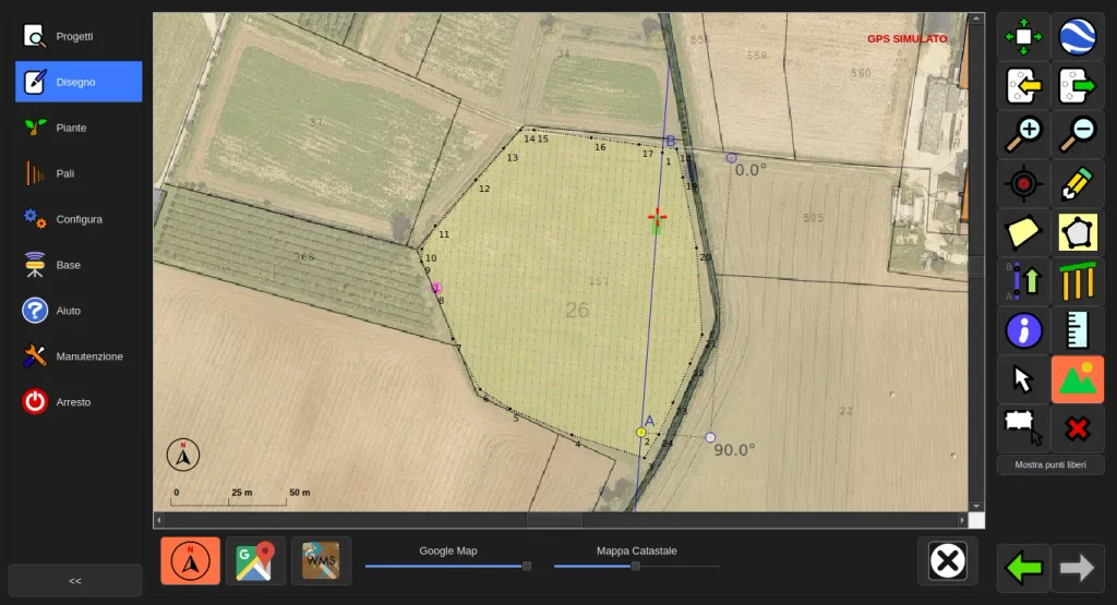
Plot design and accurate reporting on satellite and cadastral maps (Italy and France), with no need for GPS in the field. Ideal for planning the plot at your desk, with all the data ready before heading out.
DeltaSuite Extended
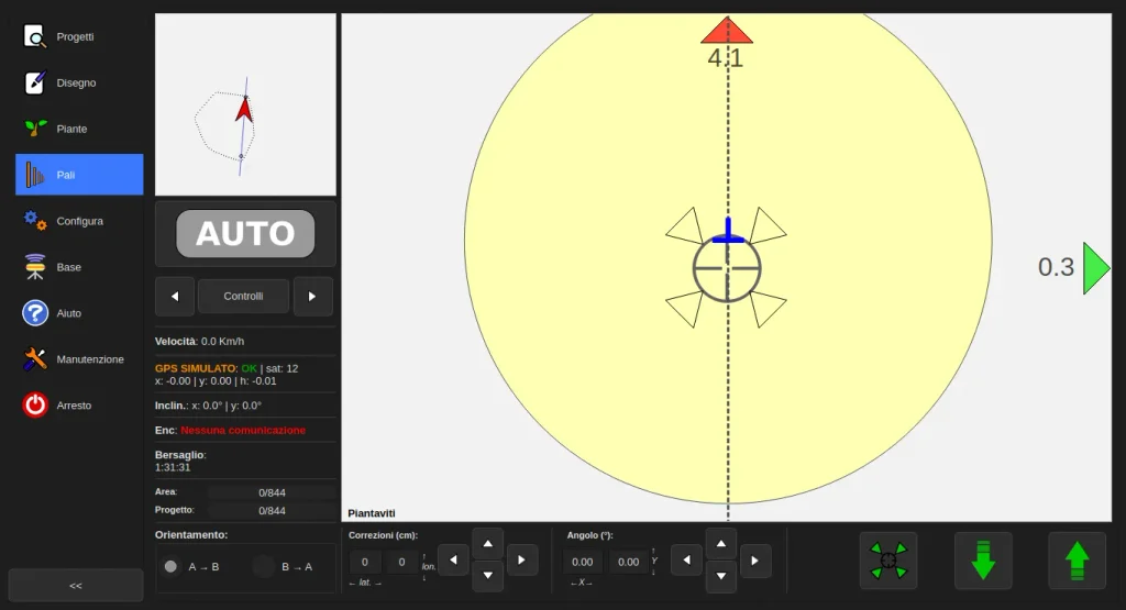
Everything included in DeltaSuite Office, plus an integrated GPS system for surveying, design and planting directly on site. Real-time changes while you work, with no need to go back to the office for every adjustment.
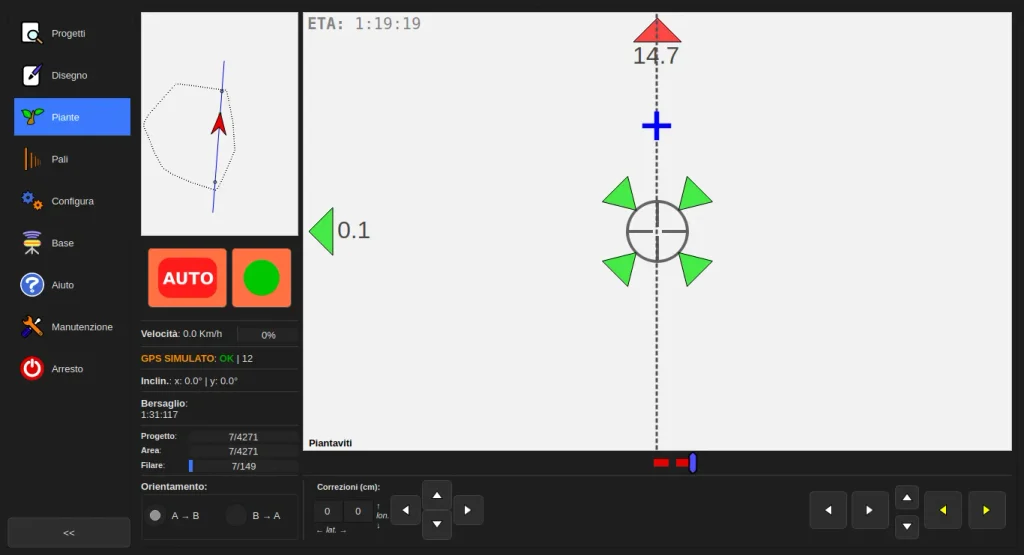
Report
PDF Report
Generating a report has never been this easy. DeltaSuite does the calculations for you. Every project automatically generates an accurate report with plant variety and count, pole type and count, distinction between head and internal poles, boundaries and headlands, perimeter, cultivable area, vine-planted area, and cadastral data for the plot. All this and more, ready to consult and share with the client.
View a sample report 👉👇
Export Format
DeltaSuite exports to the most widely used formats in the industry, ensuring compatibility with major software and guidance systems. The list is constantly updated, with new formats added over time.
Format for CAD software, with real coordinates of the plot. Useful for sharing the project with technical offices or other design software.
Standard format for GIS systems, compatible with QGIS, ArcGIS and other land management software.
Tabular format for exporting structured data (plant list, poles, coordinates), easily imported into spreadsheets.
Format for viewing the project on a map, compatible with Google Earth and other mapping platforms.
Simple format for exchanging coordinates and point data, readable by any software or machine.
ISOBUS (ISO 11783) standard for tractor parallel guidance, compatible with Fendt and other guidance systems that support the standard.
DeltaCloud
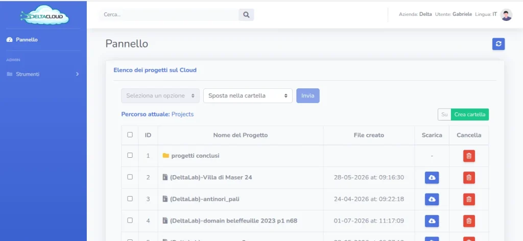
DeltaCloud is the cloud-based project management system built into DeltaSuite. If an operator in the field completes a survey, the project can be made immediately available on all other connected machines and devices, ready for work. In the same way, a last-minute change made in the office can be sent straight to the field, ready to download onto the working machine — with no manual transfer via USB sticks or other devices.
Projects can be overseen by an administrator through a dedicated web page, external to DeltaSuite but connected to DeltaCloud, from which they can manage and monitor all company projects in one place — useful for keeping an overview of ongoing sites and surveys without having to open each project on the tablet.
GPS
GPS Integration
DeltaSuite Extended is optimized to communicate with any GPS receiver in NMEA GGA format, at 5, 10 or 20 Hz, via serial or Bluetooth. Tracking is guaranteed in both single-GPS and dual-GPS configurations, for maximum flexibility in the field.
Advanced GPS Integration
With certain GPS brands, thanks to a long-standing partnership, integration goes beyond simple data communication: these receivers can be configured directly from the DeltaSuite interface. A dedicated plugin is also available for Rover diagnostics and basic configuration — radio channel, communication protocol, working mode. The result is a simpler, faster workflow, especially for support: many GPS malfunctions can be diagnosed and resolved directly from DeltaSuite, without relying on the manufacturer’s external software.
Base point initialization
Base initialization is handled comfortably from DeltaSuite: the software acquires the base coordinates for the current project and saves them alongside it. This way, the base point is never lost, and is always available for quick recall whenever you need to return to the project.
Satellite and Cadastral Map
Satellite Map
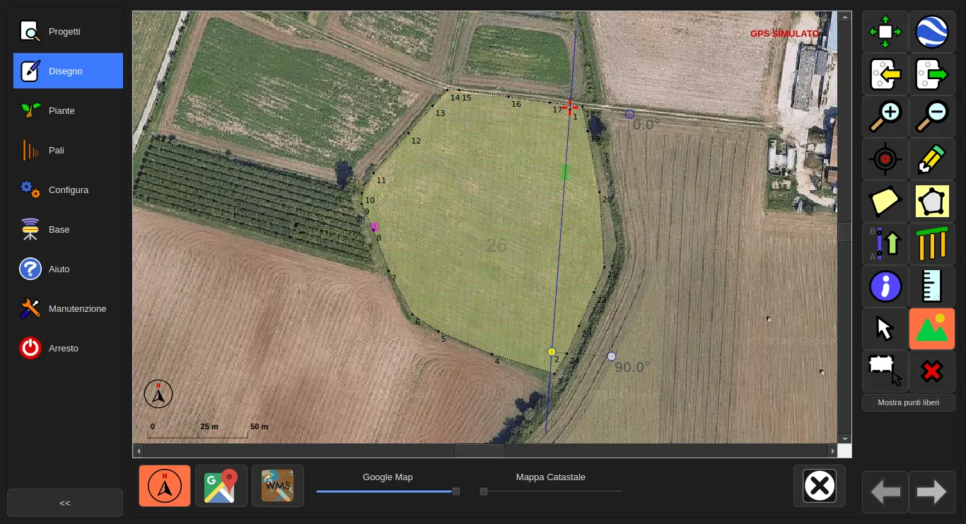
DeltaSuite allows you to download and overlay the satellite map of the area directly onto the project, so you always work with an accurate visual reference of the real terrain. The software also integrates with Google Earth, for an instant comparison between the project and the satellite view.
Cadastral map
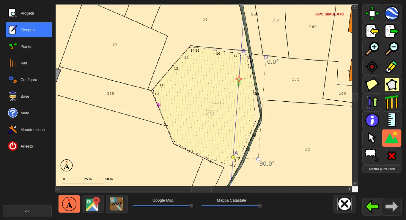
DeltaSuite allows you to download and overlay the cadastral map of the plot onto the project, to check boundaries and official references directly during design — available for Italy and France.
Features and Support
Updates
DeltaSuite is a software in constant evolution. Basic updates — fixes, bug patches, improvements — are always free, so every installation stays aligned with the latest versions at no extra cost. Basic plugins follow the same principle: free updates, included with the software.
Some advanced plugins, designed for more specific needs, are instead available for purchase — so you can extend DeltaSuite‘s functionality only where you actually need it, without paying for tools you don’t use.
Support
Support is often a real ordeal made up of tickets, unanswered calls and long waits. We, instead, aim to offer maximum availability and reliability.
Every DeltaSuite system is covered by remote support and guaranteed assistance for the first year from purchase. If issues arise, our team can step in remotely to diagnose and resolve them quickly, without stopping work in the field or waiting for an on-site visit. Whether it’s a question about using the software, a GPS malfunction, or an unexpected issue during a survey, you always have a direct point of contact ready to help.
After the first year, support remains available through an affordable subscription, with the freedom to choose whether to subscribe based on your needs.
Language Availability
DeltaSuite is available in 5 languages: Italian, English, French, Spanish and Portuguese. A real advantage for anyone working beyond national borders, or for teams with operators speaking different languages — everyone can use the software in the language they prefer, with no barriers.
Customization
Every company and every plot has different needs. That’s why we’re able to customize components and develop tailor-made features, based on the specific needs of your project — whether it’s adapting the software, a specific integration, or new development on request. We don’t just offer an off-the-shelf solution: we build the tool best suited to how you work, together with you.
Contact
Have a project to automate? Questions, support requests, or a quote? Our team is ready to respond quickly.
Address
Via del Lavoro 57 – 50056
Montelupo Fiorentino (Firenze) – Italia